Not a ranked list — there’s no honest way to rank four genuinely different drives against each other. This is a roundup of the same real logistics problem, solved four different ways: a friend who has never been out west is joining for the first 2-3 days out of Las Vegas, then flying home to Raleigh-Durham (RDU), after which the rest of the drive to Portland is solo. Each route below is a real, OSRM-routed option depending on mood, season, and which airport the buddy’s flight leaves from — and none of them loop back into Las Vegas.
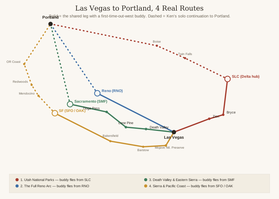
Route 1: Through Utah’s National Parks — Buddy Flies Home From Salt Lake City
Out of Las Vegas, the group leg runs through Zion and Bryce Canyon National Parks before ending in Salt Lake City.
- Las Vegas to Zion National Park via I-15: 167.1 miles, about 3 hours 27 minutes (per OSRM driving routing)
- Through Zion on UT-9, then east on UT-12 to Bryce Canyon National Park: 87.2 miles, about 2 hours 15 minutes
- Back to I-15 and north into Salt Lake City: 267.0 miles, about 4 hours 44 minutes
A 521.3-mile, roughly 10-hour-26-minute group leg, comfortably spread over 2-3 days. Discovery #109 already ran the Las Vegas-to-Salt-Lake-City corridor on I-15 in detail, including Zion; this route shares that same I-15 spine but adds Bryce Canyon, which #109 didn’t cover.
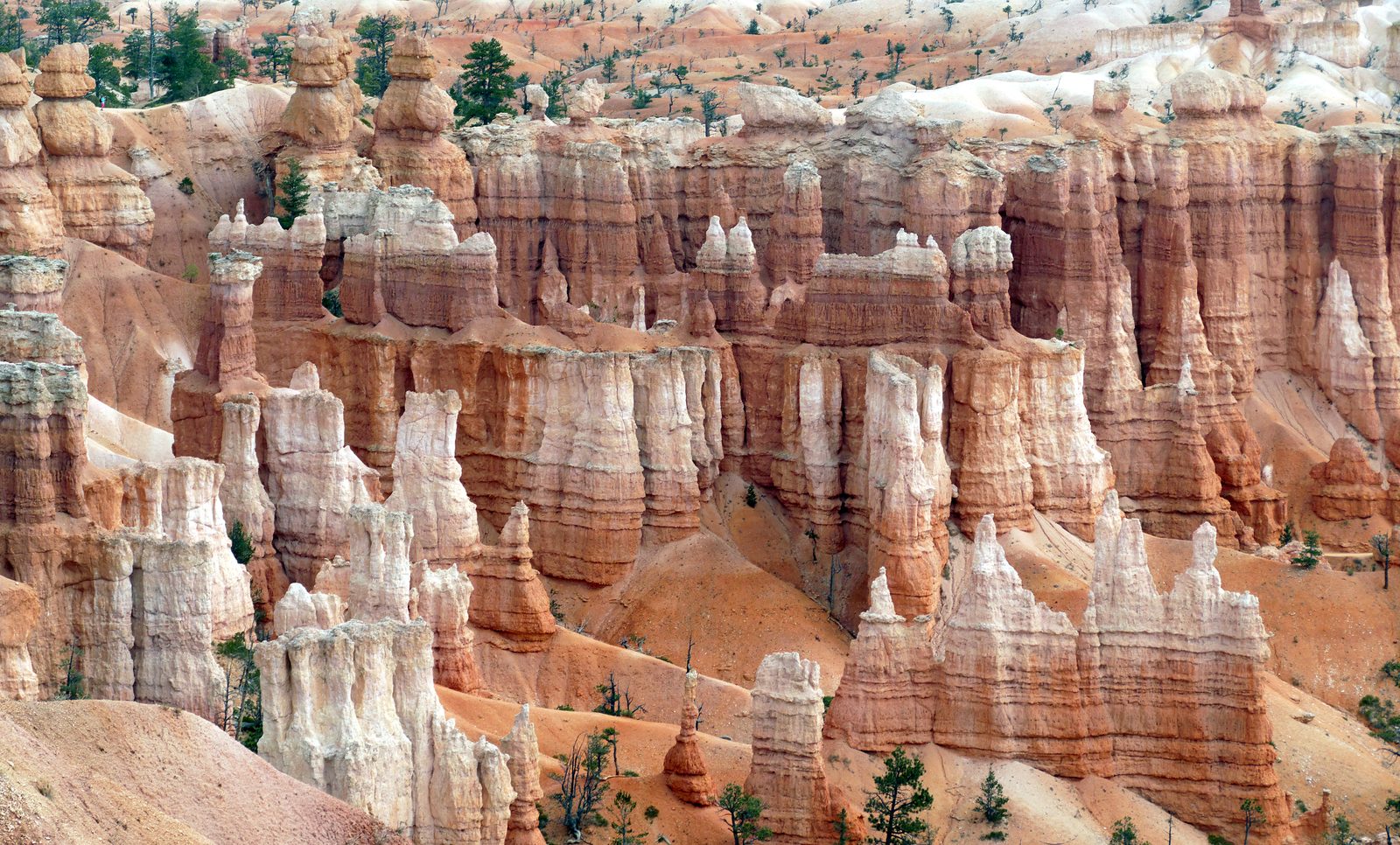
Bryce Canyon isn’t actually a canyon, per Wikipedia — it’s a collection of natural amphitheaters along the Paunsaugunt Plateau, distinctive for hoodoos, spire-shaped rock columns up to 200 feet tall, colored orange, red, and white. The largest, Bryce Amphitheater, runs 12 miles long, 3 miles wide, and 800 feet deep. Established as a national monument in 1923 by President Warren G. Harding, redesignated a national park by Congress in 1928, and it drew almost 2.5 million visitors in 2024. Source: Wikipedia, Bryce Canyon National Park.
The buddy’s flight leaves from Salt Lake City International Airport, and it’s a real, verified hub, not a guess: per Wikipedia, SLC is a hub for Delta Air Lines and sees 343 scheduled nonstop departures a day to 93 cities across North America, South America, Asia, and Europe. Delta also happens to hold the largest market share at RDU itself, per Wikipedia’s own RDU entry — a real, sourced connection between the two airports' dominant carrier, not a specific flight number or schedule, which this post doesn’t invent or claim. Sources: Wikipedia, Salt Lake City International Airport; Wikipedia, Raleigh-Durham International Airport.
Solo from there, I-15 connects to I-84 west through Idaho and on into Portland.
- Salt Lake City to Twin Falls, Idaho via I-15 to I-84: 219.3 miles, about 3 hours 44 minutes
- Twin Falls to Boise: 129.5 miles, about 2 hours 12 minutes
- Boise through the Columbia River Gorge into Portland via I-84: 430.6 miles, about 7 hours 56 minutes
A 779.4-mile, roughly 13-hour-52-minute solo leg. Grand total for this route: about 1,300.7 miles.
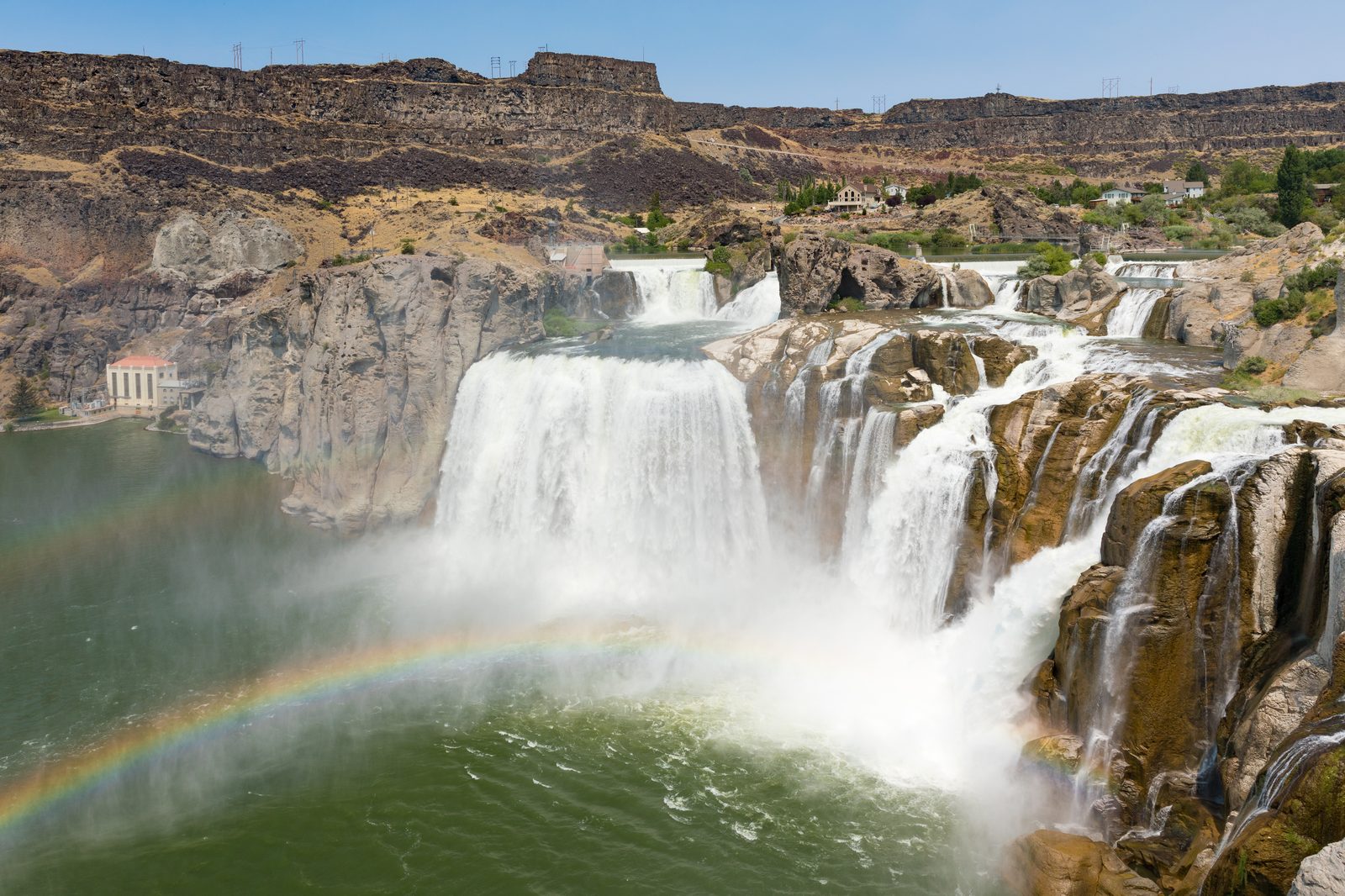
Worth the short detour into Twin Falls: Shoshone Falls, nicknamed the “Niagara of the West,” drops 212 feet — 45 feet taller than Niagara Falls — over a rim nearly 1,000 feet wide. One honest seasonal caveat: per Wikipedia, the falls are best viewed in spring, since irrigation diversion upstream significantly reduces the flow by late summer and fall, meaning a September drive-through will see noticeably less water than a spring one. Source: Wikipedia, Shoshone Falls.
Route 2: The Full Reno Arc — We Already Wrote This Whole Guidebook — Buddy Flies Home From Reno-Tahoe
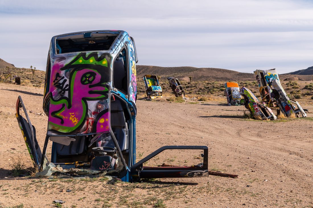
This route doesn’t need re-describing — it’s the one this whole site already covers stop by stop. Discovery #129 verified the drive itself: US-95 north out of Las Vegas through Beatty, Goldfield, and Tonopah, 431 miles, about 8.5 hours, Nevada’s own official “Free-Range Art Highway.” Once in Reno, #130 covers its six casinos and #131 covers eight non-casino things to do, and #132 closes that arc with the day trip everyone in Reno actually takes: Lake Tahoe. All four are real, live, already-verified posts — this route just points at them rather than repeating them.
The buddy’s flight leaves from Reno-Tahoe International Airport (RNO), and the honest comparison against the other three routes here: per Wikipedia, RNO is Nevada’s second-busiest commercial airport after Las Vegas, but it isn’t described as a hub for any major airline — the weakest connection of the four routes in this post, flagged plainly rather than dressed up. Source: Wikipedia, Reno-Tahoe International Airport.
Solo from Reno, there are two already-verified options, not one, and which one Ken takes solo just depends on whether the mood that week is scenic or fast:
- Discovery #133 ran the scenic US-395/Eastern Sierra route through Susanville and Crater Lake National Park: 657 miles, about 15 hours
- Discovery #134 ran the faster I-5/Sacramento corridor past Mount Shasta: 749 miles, about 15 hours
Both are real, both are live on the site, and either way, it’s already mapped.
Route 3: Death Valley and the Eastern Sierra to Sacramento — Buddy Flies Home From Sacramento
South out of Las Vegas, the route drops into Death Valley National Park before climbing north toward the Eastern Sierra.
- Las Vegas to Furnace Creek, Death Valley National Park via NV-160 and CA-190: 123.8 miles, about 2 hours 38 minutes
- Furnace Creek to Lone Pine, California via CA-190 west and US-395 north: 109.5 miles, about 2 hours 37 minutes
Per Wikipedia, Death Valley is the hottest, driest, and lowest national park in the US, containing Badwater Basin, the lowest point in North America at 282 feet below sea level. Source: Wikipedia, Death Valley National Park.
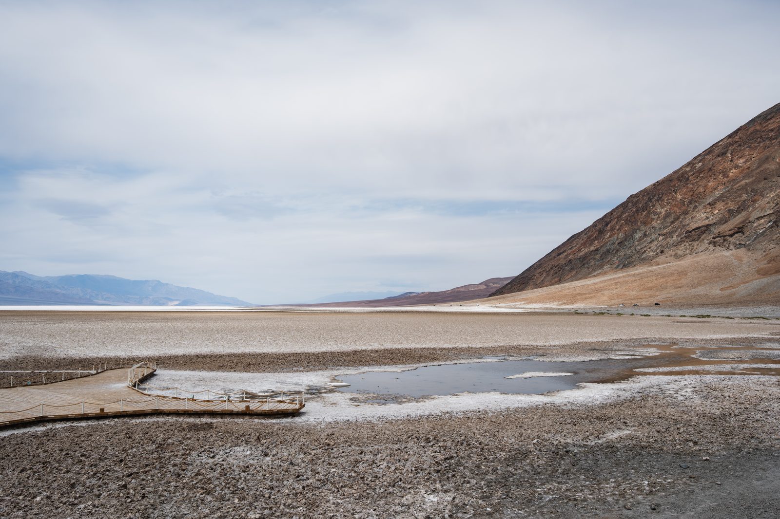
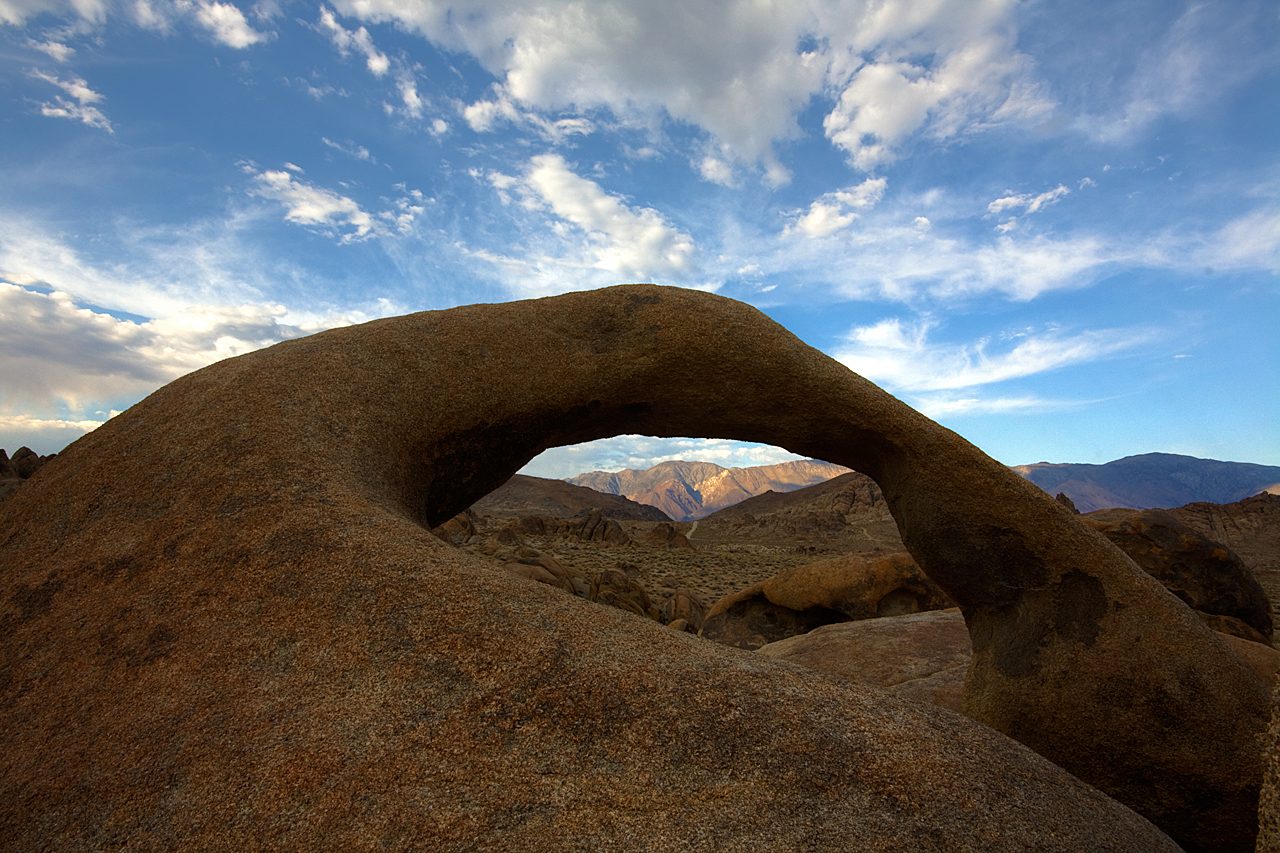
A genuinely verified geography fact worth the detour: Badwater Basin, the lowest point in the contiguous US, sits only about 88 straight-line miles from the summit of Mount Whitney, the highest point in the contiguous US at 14,505 feet — a figure computed directly from each landmark’s own geocoded coordinates rather than a repeated pop-fact. Lone Pine sits directly below Mount Whitney and the Alabama Hills, a range of rounded granite formations that Wikipedia describes as “a gateway to Mount Whitney and the Eastern Sierra Nevada,” laced with natural arches including the well-known Mobius Arch, framing the peak itself. Sources: Wikipedia, Mount Whitney; Wikipedia, Alabama Hills; nominatim.openstreetmap.org geocoding.
From Lone Pine, US-395 climbs into the Sierra toward Yosemite, then drops back down into the Central Valley toward Sacramento.
- Lone Pine to the Tioga Pass entrance of Yosemite National Park via US-395: 135.6 miles, about 2 hours 53 minutes
- Tioga Pass entrance across the Sierra crest into Yosemite Valley via CA-120/Tioga Road: 61.0 miles, about 1 hour 56 minutes
- Yosemite Valley down Big Oak Flat Road and CA-120 into the Central Valley and north to Sacramento: 163.0 miles, about 4 hours 4 minutes
One honest, non-negotiable caveat: Tioga Pass, at 9,945 feet the highest highway pass in California, is subject to seasonal closure typically running from late October through late May, but per Wikipedia that window varies considerably — in heavy snow years it has closed as early as early October. This post can’t verify live 2026 CalTrans road-status data with the tools available, so treat this as a historically-open-in-late-September pattern, not a confirmed current status — check CalTrans QuickMap before counting on it. If it’s closed, Sonora Pass on CA-108 is a real, verified backup: routed from Lone Pine, it runs a similar 350.3 miles and 7 hours 49 minutes into Sacramento, closing on roughly the same November-to-May seasonal pattern, though Wikipedia describes its grades as steeper and narrower than Tioga’s. Sources: Wikipedia, Tioga Pass; Wikipedia, Sonora Pass; router.project-osrm.org routing data.
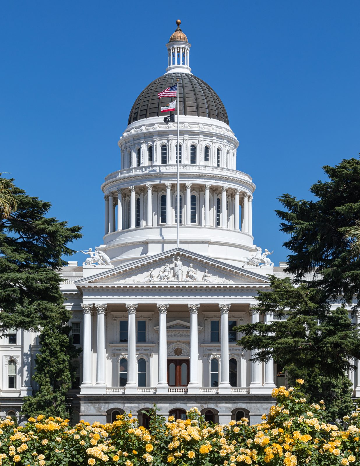
The buddy’s flight leaves from Sacramento International Airport. Per Wikipedia, it’s the primary airport serving the Sacramento metro area, but like Reno-Tahoe, it isn’t described as a hub for any major carrier — a real airport, not a major connecting hub. Source: Wikipedia, Sacramento International Airport.
Solo from Sacramento, no need to re-verify a new route: Discovery #134’s own already-checked I-5 corridor covers exactly this ground north of Sacramento.
- Sacramento to Redding: 161 miles, about 3 hours
- Redding to the town of Mount Shasta: 75 miles, about 1 hour 35 minutes
- Mount Shasta to Ashland, Oregon: 90 miles, about 1 hour 55 minutes
- Ashland to Eugene: 179 miles, about 3 hours 35 minutes
- Eugene to Portland: 111 miles, about 2 hours 20 minutes
A 616-mile, roughly 12-hour-25-minute solo continuation, reusing #134’s own verified figures rather than re-running the same route through OSRM twice.
Route 4: The Sierra and the Pacific Coast via San Francisco — the Totally Different Scenery Option — Buddy Flies Home From SFO or OAK
The deliberate outlier of the four: desert and mountains give way entirely to coastline. South out of Las Vegas on I-15, then west into the Mojave Desert toward the Bay Area.
- Las Vegas to Kelso, Mojave National Preserve: 93.3 miles, about 1 hour 56 minutes
- Kelso to Barstow: 102.5 miles, about 1 hour 59 minutes
- Barstow to Bakersfield: 130.3 miles, about 2 hours 32 minutes
- Bakersfield to San Francisco: 281.8 miles, about 5 hours 18 minutes
A 607.9-mile, roughly 11-hour-45-minute group leg.
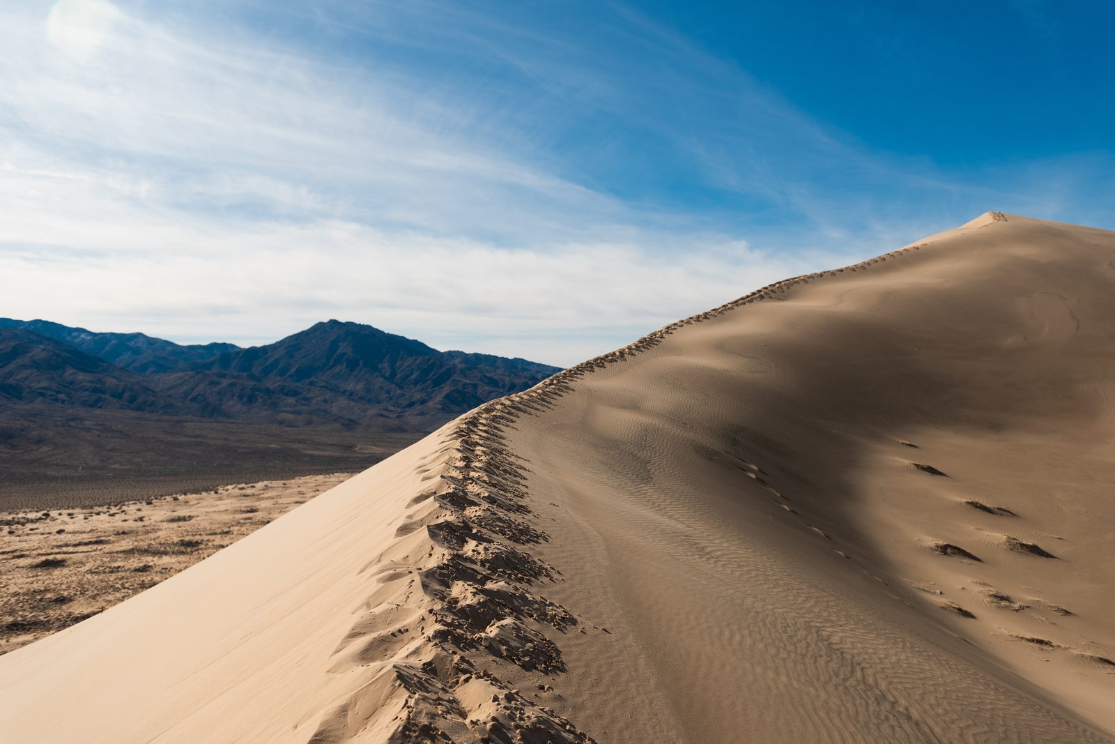
Per Wikipedia, Mojave National Preserve is the largest national preserve and the third-largest unit of the entire National Park System in the contiguous US, established in 1994 by the same California Desert Protection Act that created Death Valley National Park. The Joshua tree forest covering its Cima Dome is described as the largest and densest in the world, and the Kelso Dunes are one of its signature features. One honest, current caveat: the historic Kelso Depot, the preserve’s official visitor center since 1905, was still listed as temporarily closed for renovation as of Wikipedia’s most recent update — the desert scenery is fully open, the visitor center itself may not be. Source: Wikipedia, Mojave National Preserve; Wikipedia, Kelso Depot.
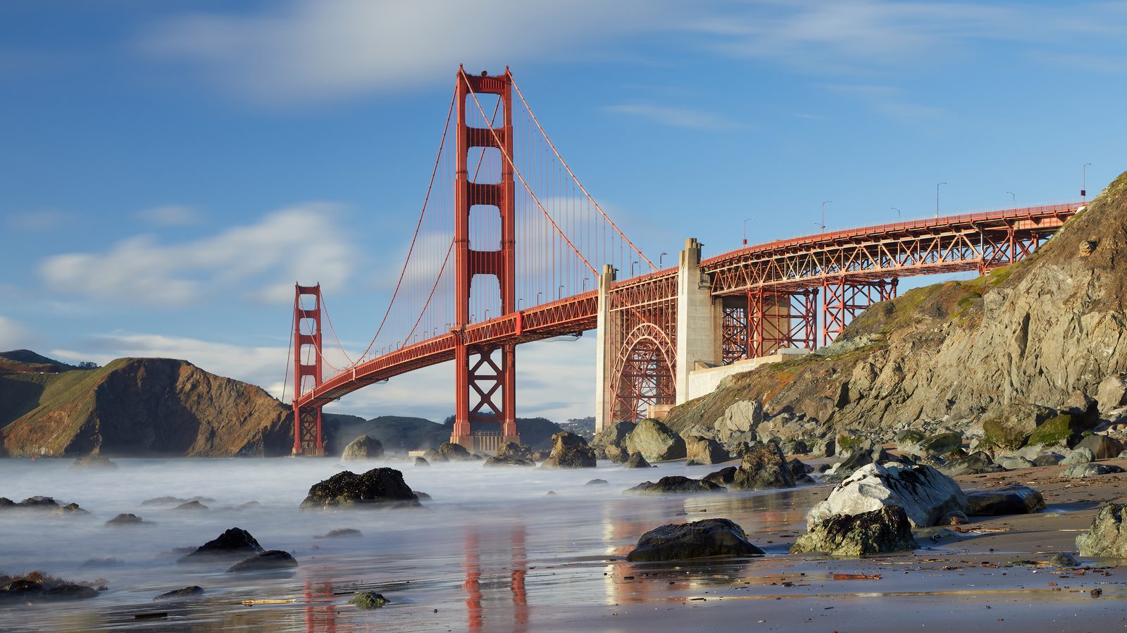
The buddy has two real airport options here, and this is genuinely the strongest hub of all four routes, sourced rather than assumed: per Wikipedia, San Francisco International Airport (SFO) is a hub for United Airlines, serving as the airline’s primary transpacific gateway and a major maintenance facility, and it’s also a hub for Alaska Airlines. Across the bay, Oakland International Airport (OAK) is an operating base for Southwest Airlines. Neither claim here extends to a specific nonstop flight, flight number, or schedule to RDU — just verified, sourced hub status, genuinely stronger than SLC, RNO, or SMF. Sources: Wikipedia, San Francisco International Airport; Wikipedia, Oakland International Airport.
Solo from San Francisco, US-101 and CA-1 (the Pacific Coast Highway) run north along the coast before turning inland into Portland.
- San Francisco to Mendocino: 142.3 miles, about 3 hours 50 minutes
- Mendocino to the Avenue of the Giants and Humboldt Redwoods State Park: 96.7 miles, about 2 hours 35 minutes
- Humboldt Redwoods State Park to Brookings, just across the Oregon border: 164.5 miles, about 3 hours 35 minutes
- Brookings inland via I-5 into Portland: 343.8 miles, about 7 hours 13 minutes
A 747.3-mile, roughly 17-hour-14-minute solo leg. Grand total for this route: about 1,355.2 miles, the longest of the four.
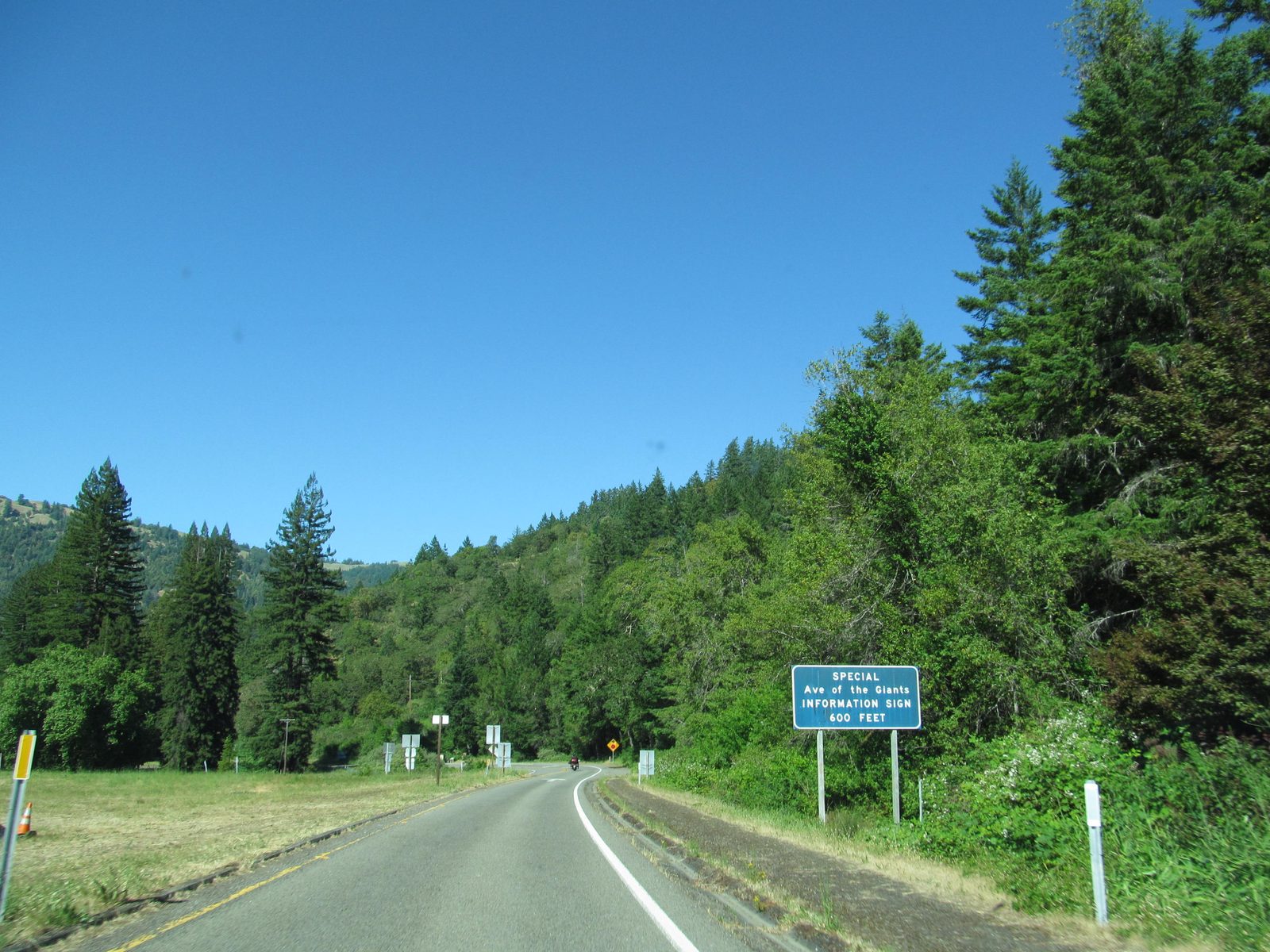
Humboldt Redwoods State Park, which the Avenue of the Giants runs directly through, protects Rockefeller Forest — per Wikipedia, the world’s largest remaining contiguous old-growth forest of coast redwoods, some individual trees over 300 feet tall. It’s the real payoff of this route: nothing on the other three options looks anything like it. Source: Wikipedia, Humboldt Redwoods State Park.
Which Route Gets Him Home Fastest — and Cheapest
Pulling the group-leg drive figures from above together against each airport’s own nonstop situation and a rough sense of fare:
- Route 1, to Salt Lake City (SLC): 521.3 miles, about 10 hours 26 minutes of driving. SLC has real nonstop RDU service on Delta — the only one of the four airports here with a direct flight. Today’s general fare-aggregator listings put that at roughly seven Delta departures a week, running about $130–$350 one-way for a Friday or Saturday departure.
- Route 2, to Reno (RNO): 431 miles, about 8 hours 30 minutes — the shortest drive of the four, reusing #129’s own verified figure. RNO has no nonstop to RDU; every fare-aggregator option requires at least one connection, running roughly $180–$400 one-way.
- Route 3, to Sacramento (SMF), via Tioga Pass: summing this route’s own sub-legs above — Furnace Creek, Lone Pine, the Tioga Pass entrance, Tioga Road, and the leg into Sacramento — comes to 592.9 miles, about 14 hours 8 minutes, the longest drive of the four to a departure airport. (If Tioga’s closed and the Sonora Pass backup gets used instead, those same sub-legs total roughly 583.6 miles and 13 hours 4 minutes — about an hour faster.) SMF also has no nonstop to RDU; a connection is required, and fare-aggregator listings run roughly $150–$300 one-way.
- Route 4, to San Francisco (SFO) or Oakland (OAK): 607.9 miles, about 11 hours 45 minutes. SFO has real nonstop RDU service — a roughly 5-hour-20-minute flight — and remains the strongest hub of the four airports here. Fare-aggregator listings run roughly $140–$300 one-way.
One honest caveat on those price ranges: they aren’t personal quotes, they’re a dated snapshot pulled from general fare-aggregator route pages (Kayak, Expedia, Skyscanner) on September 23, 2026, for a Friday or Saturday departure. Airfare changes constantly and tends to climb the closer it gets to the actual weekend of departure, so treat these as ballpark planning ranges, not numbers to book against — check a live fare search before buying. The nonstop-versus-connection status for each airport, by contrast, is a stable route-network fact rather than a price snapshot: SLC and SFO have nonstop RDU service today, RNO and SMF don’t.
Four real routes, four real airports, and one shared ending: whichever route gets picked, it lands in Portland, where Discovery #135 and #136 already cover what to do once you’re there — #135 for the city’s general highlights, #136 for its brewery scene specifically. Every leg above was checked through OSRM driving routing rather than assumed from a map glance, every airport hub claim is sourced to Wikipedia rather than invented, and the one genuinely unverifiable detail — Tioga Pass’s live 2026 status — is flagged as exactly that instead of asserted either way.