Discovery #133 ran the scenic route north out of Reno: US-395 and the Eastern Sierra/high desert, all the way to Crater Lake and Bend before dropping into Portland. This is the sibling post the same ticket asked for, not a rerun — the faster, more direct way to make the same Reno-to-Portland trip. The route was verified through OSRM driving routing rather than assumed, leg by leg: Reno west on I-80 to Sacramento (132 miles, about 2 hours 35 minutes); Sacramento north on I-5 to Redding (161 miles, about 3 hours); Redding continuing north on I-5 to the town of Mount Shasta (75 miles, about 1 hour 35 minutes); Mount Shasta north on I-5 across the Oregon border to Ashland (90 miles, about 1 hour 55 minutes); Ashland north on I-5 to Eugene (179 miles, about 3 hours 35 minutes); and Eugene north on I-5 the rest of the way into Portland (111 miles, about 2 hours 20 minutes). Total: roughly 749 miles and 15 hours of actual driving time. OSRM's own step-by-step road names confirm this is genuinely I-80 then I-5 essentially the entire way, not an invented shortcut.
One honest correction, since it's easy to lump "Shasta" in as a single stop without checking: Shasta Dam itself is not directly on I-5. Routed directly through OSRM from Redding, the dam sits about 14.4 miles and roughly 35 minutes off the interstate, a genuine detour rather than a pass-through. Shasta Lake, however, is confirmed on-route — per Wikipedia's own account of the lake's marinas, I-5 runs directly along and above the lake for miles, with resorts like the Shasta Marina Resort reached straight from the interstate's own exit 693 near Lakehead, no detour required. And per the ticket's own instruction, this route shares no stops with Discovery #133: no Susanville, Lakeview, Bend, Mount Bachelor, or Crater Lake anywhere below. Counted down from #6 to #1.
6. Sacramento — California’s State Capital Since 1854, and the Historic District That Predates It
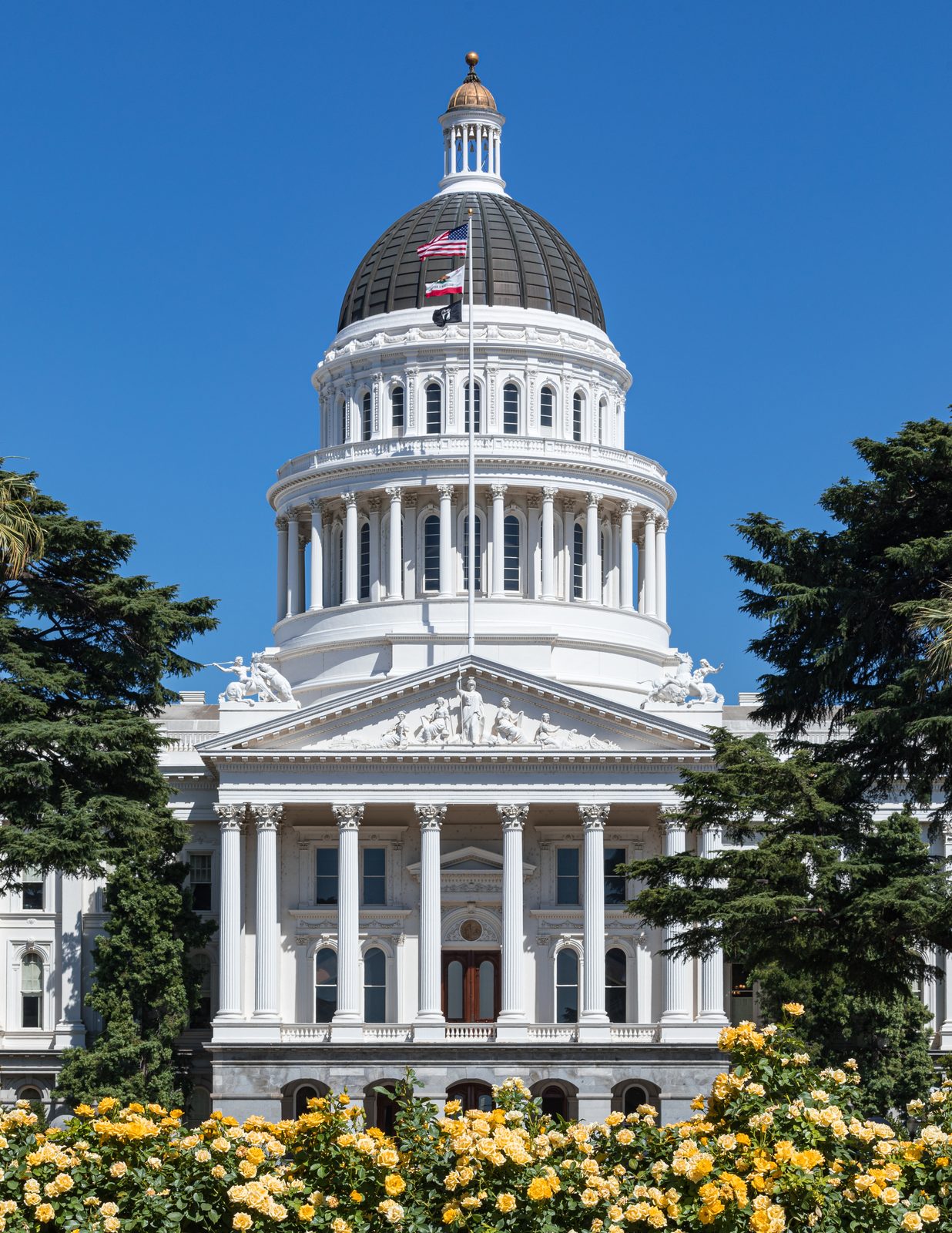
Per Wikipedia, Sacramento is the capital city of California and the seat of Sacramento County, sitting at the confluence of the Sacramento and American Rivers, and it's the fourth-most populous city in Northern California. The California State Capitol itself, a Neoclassical building designed by Reuben S. Clark, was completed between 1861 and 1874 and houses both chambers of the state legislature and the governor's office; it's been on the National Register of Historic Places since 1973, and the California State Capitol Museum sits right on its grounds. A short walk away is the Old Sacramento Historic District, a U.S. National Historic Landmark District that's been restored and developed as a tourist attraction since the 1960s, commonly shortened to "Old Sac" or "Old Town Sac." Source: Wikipedia, Sacramento, California.
5. Redding — Santiago Calatrava’s 2004 Sundial Bridge, a $23.5 Million Cantilever Spar Cable-Stayed Bridge That Doubles as an Actual Sundial
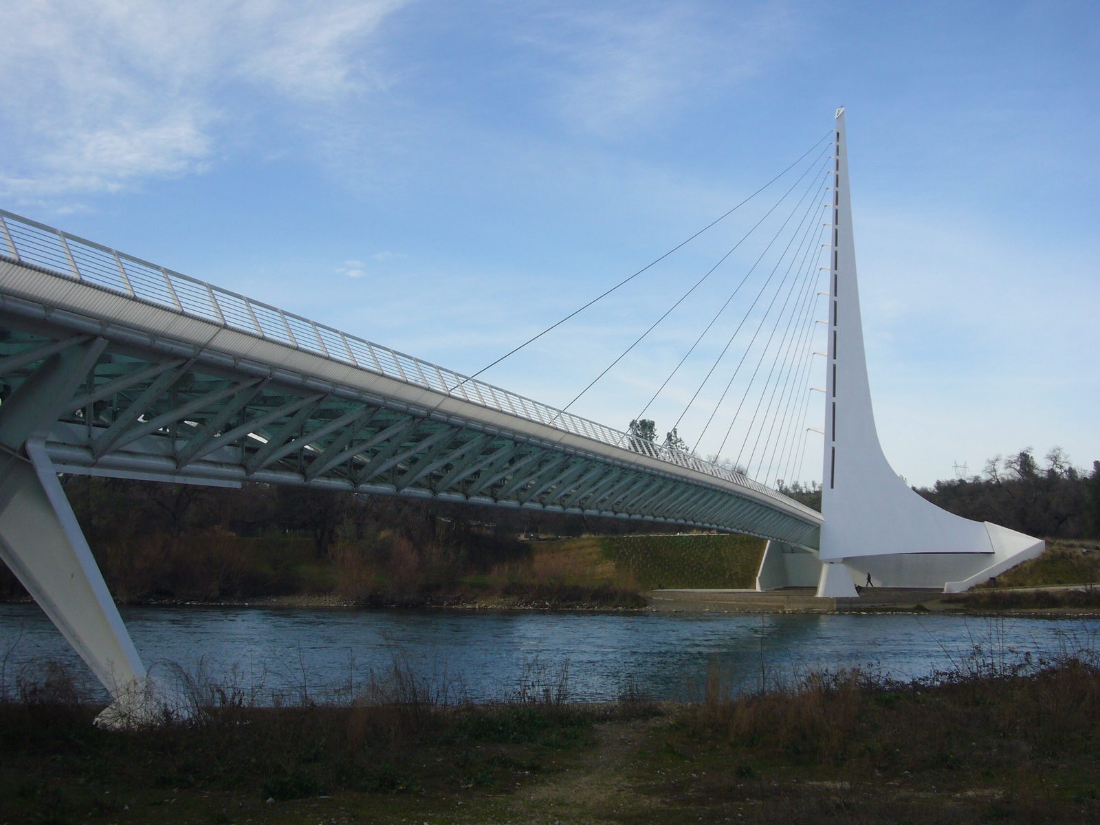
Per Wikipedia, Redding is the seat of Shasta County and the economic and cultural capital of the Shasta Cascade region, sitting along the Sacramento River about 162 miles north of Sacramento itself and 120 miles south of the Oregon border — putting it almost exactly at the route's midpoint. Its signature landmark is the Sundial Bridge at Turtle Bay, a cantilever spar cable-stayed bridge for bicycles and pedestrians that spans the Sacramento River and forms a genuine working sundial. It was designed by the Spanish architect Santiago Calatrava, completed in 2004 at a cost of $23.5 million, and per Wikipedia it's become the iconic image of the city. Source: Wikipedia, Sundial Bridge at Turtle Bay.
4. Shasta Lake — California’s Largest Reservoir, Run Alongside Directly by I-5, No Detour Required
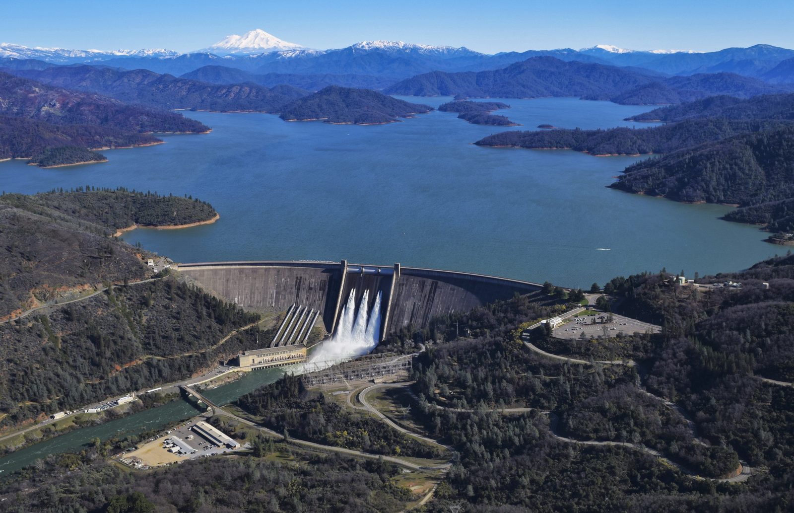
Per Wikipedia, Shasta Lake (popularly "Lake Shasta") began storing water in 1944 after Shasta Dam impounded the Sacramento River, and it's the largest reservoir in California, holding about 4,500,000 acre-feet. The dam that creates it, at 602 feet, is the eighth-tallest dam in the United States. As noted above, the dam itself is a real 14.4-mile detour off I-5 from Redding — but the lake is genuinely on-route: Wikipedia's own rundown of the lake's marinas confirms I-5 runs directly along and above it for miles, with the Shasta Marina Resort reached straight from I-5's own exit 693 near Lakehead, and other marinas a short drive off the interstate rather than requiring a real detour. Source: Wikipedia, Shasta Lake.
3. Ashland, Oregon — the 1935 Oregon Shakespeare Festival, and the 93-Acre Park Named for Lithium in the Water
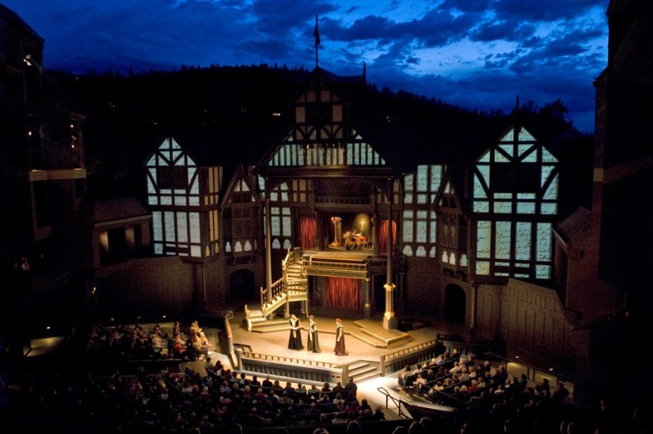
Per Wikipedia, Ashland lies directly on I-5 in Jackson County, Oregon, about 16 miles north of the California border near the south end of the Rogue Valley. It's home to the Oregon Shakespeare Festival, a regional repertory theatre founded in 1935 by Angus L. Bowmer that now stages classic and contemporary plays well beyond just Shakespeare, running between five and eleven productions in rotation across three theatres; per Wikipedia it drew its 20-millionth visitor in 2015 and now welcomes about 350,000 visitors a year. Right downtown is Lithia Park, Ashland's largest and most central park at 93 forested acres along Ashland Creek, named for the lithia (lithium oxide) found in the creek water that's pumped into the park. Sources: Wikipedia, Ashland, Oregon; Wikipedia, Oregon Shakespeare Festival; Wikipedia, Lithia Park.
2. Eugene, Oregon — Home of the Oregon Ducks and Autzen Stadium, Plus the Hult Center for the Performing Arts
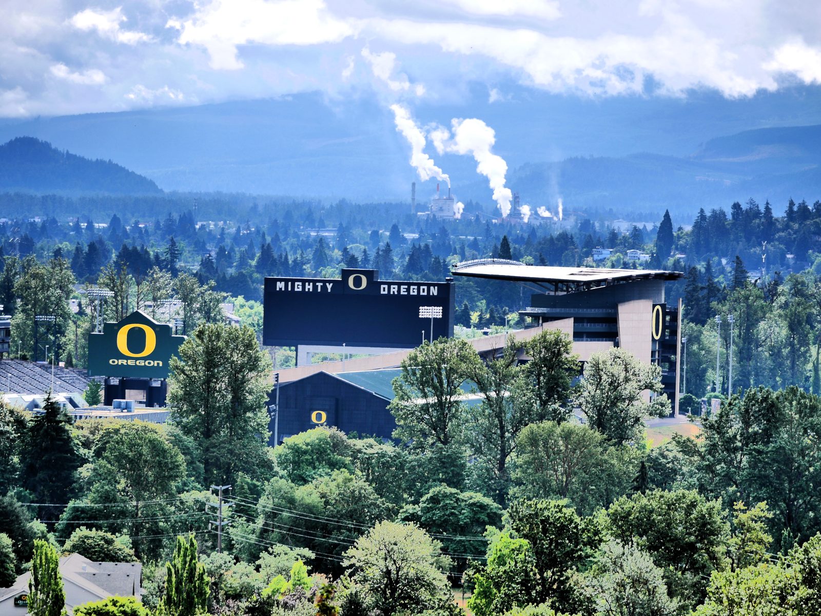
Per Wikipedia, Eugene is the seat of Lane County at the southern end of the Willamette Valley, roughly 110 miles south of Portland and directly on I-5. It's home to the University of Oregon, founded in 1876, whose Oregon Ducks compete in the Big Ten and, per Wikipedia, are best known for football and a track and field program that's helped Eugene earn the nickname "Track Town, USA." The football team plays at Autzen Stadium on campus. Downtown, the Hult Center for the Performing Arts is Eugene's own performing arts venue, home to concerts, theater, and touring productions. Sources: Wikipedia, Eugene, Oregon; Wikipedia, University of Oregon; Wikipedia, Oregon Ducks.
1. Mount Shasta — a 14,179-Foot Stratovolcano, the Most Voluminous in the Entire Cascade Range, Visible From I-5 for Miles
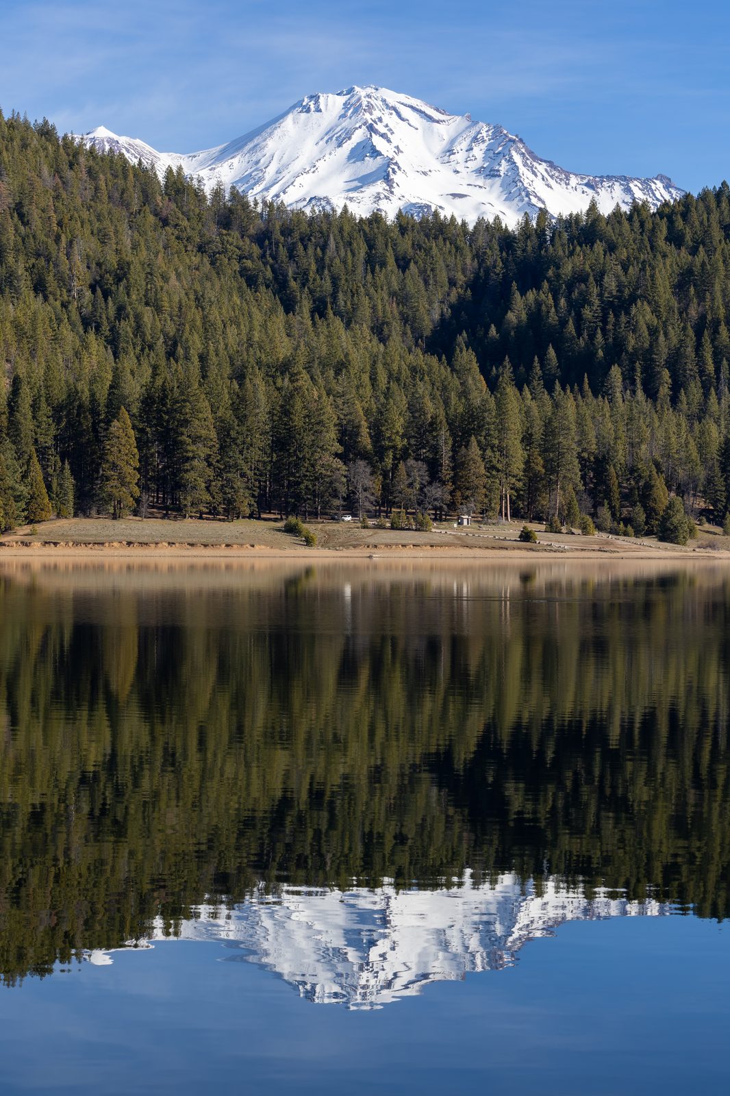
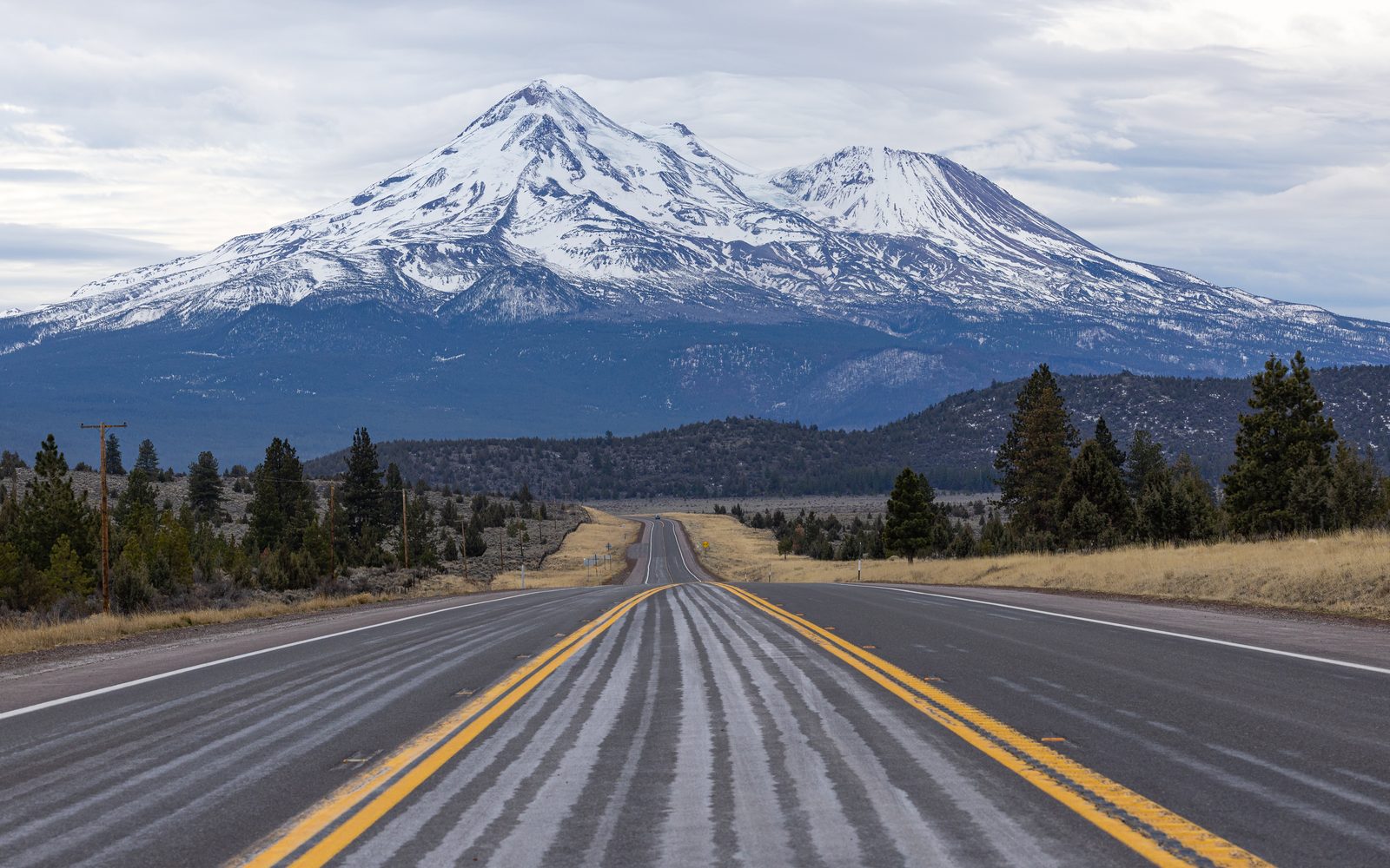
The mountain, not just the town at its base. Per Wikipedia, Mount Shasta is a potentially active stratovolcano at the southern end of the Cascade Range in Siskiyou County, reaching 14,179 feet, the second-highest peak in the Cascades and the fifth-highest in California. With an estimated volume of 85 cubic miles, it's the most voluminous stratovolcano in the entire Cascade Volcanic Arc. The city of Mount Shasta itself sits at about 3,600 feet on the mountain's flanks, less than 9 miles southwest of the summit, per its own Wikipedia article. Unlike Crater Lake on Discovery #133's route, there's no detour required here at all — I-5 runs right past it, and the mountain stays visible from the highway for dozens of miles in both directions, making it the actual, unmissable anchor of this route rather than a side trip. Source: Wikipedia, Mount Shasta.
A note on scope, since the ticket flagged it directly: this is one of two sibling posts covering the same eventual Reno-to-Portland arc, each via a genuinely different real route. Discovery #133 ran the scenic, less-trafficked US-395/Eastern Sierra corridor through Susanville, Lakeview, and Crater Lake. This one runs the faster I-5 corridor through Sacramento, Redding, and Ashland instead. Neither post repeats the other's stops.
Six stops on the actual route, plus one honestly flagged detour: Sacramento, California's capital since 1854, with its 1874 State Capitol and the Old Sacramento Historic District; Redding and Santiago Calatrava's 2004 Sundial Bridge; Shasta Lake, California's largest reservoir, run alongside directly by I-5 (with Shasta Dam itself flagged as a real 14.4-mile detour, not on-route); Ashland's 1935 Oregon Shakespeare Festival and 93-acre Lithia Park; Eugene, home to the Oregon Ducks and the Hult Center; and Mount Shasta at #1, a 14,179-foot stratovolcano and the most voluminous in the whole Cascade Range, visible from the highway for miles — the direct, no-detour-needed payoff to close out this faster sibling route.