I was today days old when I learned there’s a phone app that you point at any mountain skyline and it overlays the name and elevation of every peak in view, in real time, via AR — for over a million peaks worldwide, with a 300 km / 200 mi render range, fully offline (no data plan needed in the mountains), for a $5 one-time purchase. No subscription. No ads. It’s PeakFinder, built and run by one Swiss developer in Zurich since the early 2010s. Apple noticed it within three months and made it App of the Week. It was the most-downloaded paid iPhone app of 2017 in Switzerland. And it’s still just one guy shipping it.
What it is:
PeakFinder is a point-and-overlay augmented-reality app for identifying mountain peaks. Open the app on a hike, point your phone at the horizon, and the names + elevations of every peak in view get drawn onto the live camera feed in real time — the peak you can’t quite ID gets labeled before you finish asking. Don’t feel like pointing? There’s a 360° panorama mode that lets you scroll around from your current location without holding the phone up at all. The catalog is the headline number: more than 1,000,000 named peaks worldwide, Everest down to local hills nobody’s heard of. The render range is the second headline: PeakFinder draws peaks up to 300 km / 200 mi away, so the distant ridge on the horizon gets named alongside the one a kilometer in front of you. And the third one is the killer: it’s fully offline. The app uses GPS + compass + accelerometer plus a built-in Digital Elevation Model — the DEM ships inside the app rather than being streamed on demand — so it works in airplane mode, in a Swiss valley with no cell signal, on a Dolomites ridge two days from the nearest tower. No data plan needed in the mountains, which is the exact place you’d need it.
Who built it:
Fabio Soldati, one developer in Zurich, Switzerland, running PeakFinder as an indie shop since the early 2010s. No team, no investors, no acquisition. The editorial centerpiece of the whole story isn’t the AR or the 1M-peak database — it’s this: within three months of launch Apple made PeakFinder its “App of the Week,” and in 2017 it became the most-downloaded paid iPhone app of the year in Switzerland. One Swiss guy, building it alone, out-downloaded every paid app in his home market in a single year. National Geographic ran a “Best New Apps: PeakFinder Makes Virtual Peak Bagging Easy” piece about it. Over a million downloads to date. Sibling lane to #051 Photopea (Ivan Kutskir, Prague, single-developer browser-based Photoshop): there’s a whole category of indie software in 2026 that is one person, one continent, one decade of compounding work, and a global user base — PeakFinder is the mountain-skyline version of it.
The $5-one-time business model (and what makes it rare):
The load-bearing thing about PeakFinder in 2026 isn’t the AR. It’s the price. About $5 USD, one time, on the iOS or Android app store. No subscription. No ads. No in-app purchases. No “PeakFinder Pro” upgrade nag that pops up every time you open it. You buy it once and the app is yours. In a market where every other outdoor / mountain / map / weather / hiking app has moved to $5–$15 per month with a paywall halfway through the onboarding, PeakFinder still ships at the price model that used to be the default in the App Store and is now almost extinct. That’s the kind of indie-software economics one solo developer can run sustainably and a 200-person company can’t — no growth team to feed, no quarterly recurring-revenue target, no board deck. It’s also why you can trust the app: the PeakFinder you install today is going to be the same product in five years, because the business model doesn’t require it to mutate into a subscription-driven recommendation engine to keep the lights on. The $5-once is the trust signal.
How to use it (and the free web version):
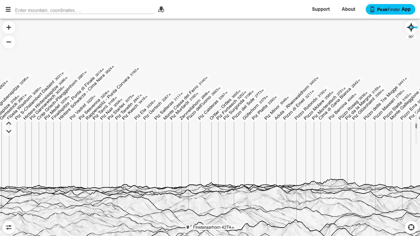
Install on iOS or Android for about $5. On a hike, open the app, point your phone at any horizon, and the names overlay in real time. For pre-trip planning, armchair use, or anyone who just wants to see what the thing does before paying, there’s a free web version at peakfinder.com — no GPS needed, you “fly to” any location on the planet and scroll the full 360° panorama from that point. Drop yourself on the Italian Apennines, the Dolomites, a hotel terrace in the Bernese Alps, the deck of a cabin in Banff — whatever skyline you’re curious about, it renders the labeled peaks. The screenshot above is the live web version: Bernese Alps from the panorama mode, Finsteraarhorn 4,249m dead center, dozens of named summits stretched out in tiny vertical text along the silhouette. Sibling-lane callback to #021 Flightradar24 and #056 Runway DFW: those name what’s in the sky and what’s on the runway in real time; PeakFinder names what’s on the horizon in real time. Same family of tag-everything-you-can-see tools, applied to the oldest skyline humans ever stared at. Try the web version at peakfinder.com first; if you live within sight of anything taller than a hill, the $5 phone version pays for itself the first time you point it at a ridge.